

PLAT 15-D, Town Of East Greenwich
The above map shows the physical proximity and the directional relationship of the two cemeteries, No.9 and No.10, where one of the Spencer lines is buried. The map is PLAT 15-D, Town Of East Greenwich, TAX ASSESSOR’S MAPS/ZONING MAPS (Map Revision Dates from June 30, 1973 to May 1, 2001).
Note that the western boundary of the Straight Cemetery–No.10 above– (aka Over-back) meets the eastern boundary of the Spencer Cemetery–No.9 above– on approximately the same longitude, only 1383 feet apart. Since the first generation is always buried on the western most part of cemetery, this could be the reason for the placement of the new cemetery boundary. The first Spencers buried in the new cemetery are also on the western side. The following generations are buried to the east of the first row.
The main purpose of this webpage is to make very clear the connection between the No. 9 historical cemetery and the No. 10 historical cemetery on the above map. The Spencer Family Cemetery (E.G. Historical Cemetery No. 9) on Middle Road is the newer cemetery where seven generations of William and Mary (née Manchester) Spencer’s descendents are buried. William and Mary (née Manchester) Spencer are buried in the No. 10 on the above map.
The older or original cemetery that the Spencer ancestors always called “Over-back Cemetery” (AKA the Straight Cemetery) is where the Spencer couple, William and Mary (née Manchester) Spencer, who purchased the land on Middle Road in 1750 are buried. The name, “Over-back” is in reference from the newer cemetery on Middle Road. “Over-back Cemetery” is 1383 feet to the south–to the back— of the new cemetery (East Greenwich historical cemetery No. 9) and over the connecting stonewall.
Audrey Mae (née Spencer) MacDonald promised her father, William J.B. Spencer, that she would keep the relationship between these two cemeteries in the descendents awareness as William J.B. Spencer had promised his father, John Johnson Spencer, a Civil War Veteran. This website will keep this promise alive.
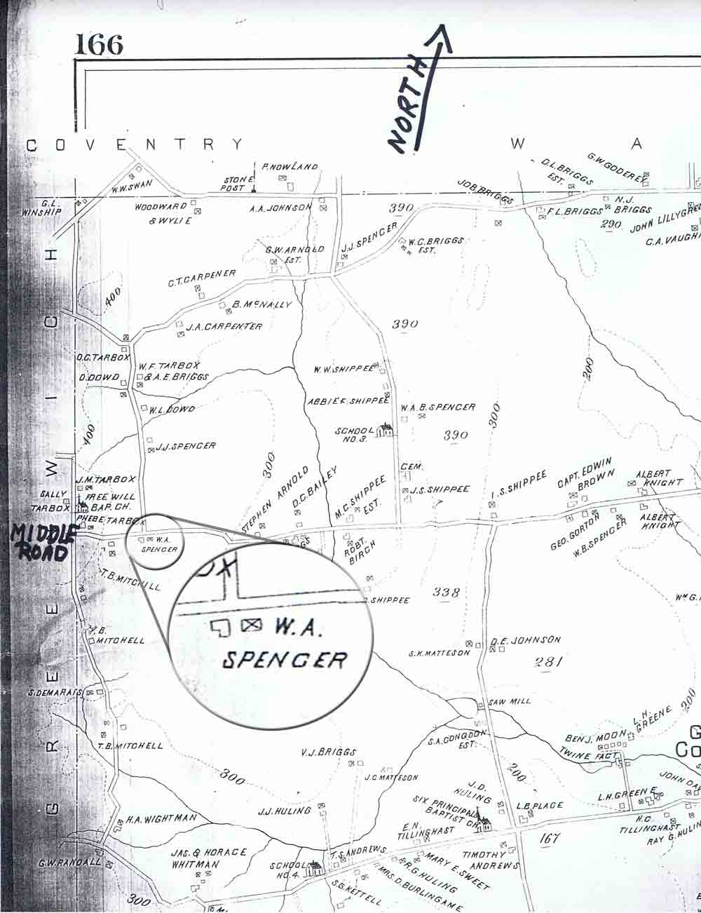
Map located in the Heritage Room at East Greenwich Free Library
When Middle Road came through, the Spencers began the new cemetery on Middle Road. The Spencers discontinued the use of the Straight Cemetery, and at this time in history began referring to the Straight Cemetery as the “Over-back” cemetery–over the stonewall and to the back. The map section above, located in the Heritage Room at East Greenwich Free Library, East Greenwich, R.I. illustrates that the land of W. A. Spencer– William Augustus Spencer–is south of Middle Road and east of Carr’s Pond Road. The Spencers purchased the Straight Family land, south of Middle Road, in 1750 and sold the land in 1922.